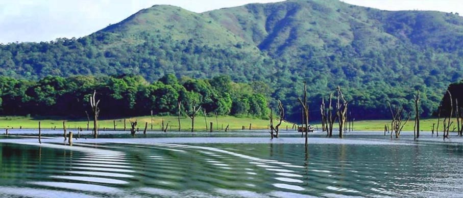
The Story behind Thekkady’s Lake: How a Dam Reshaped a Landscape
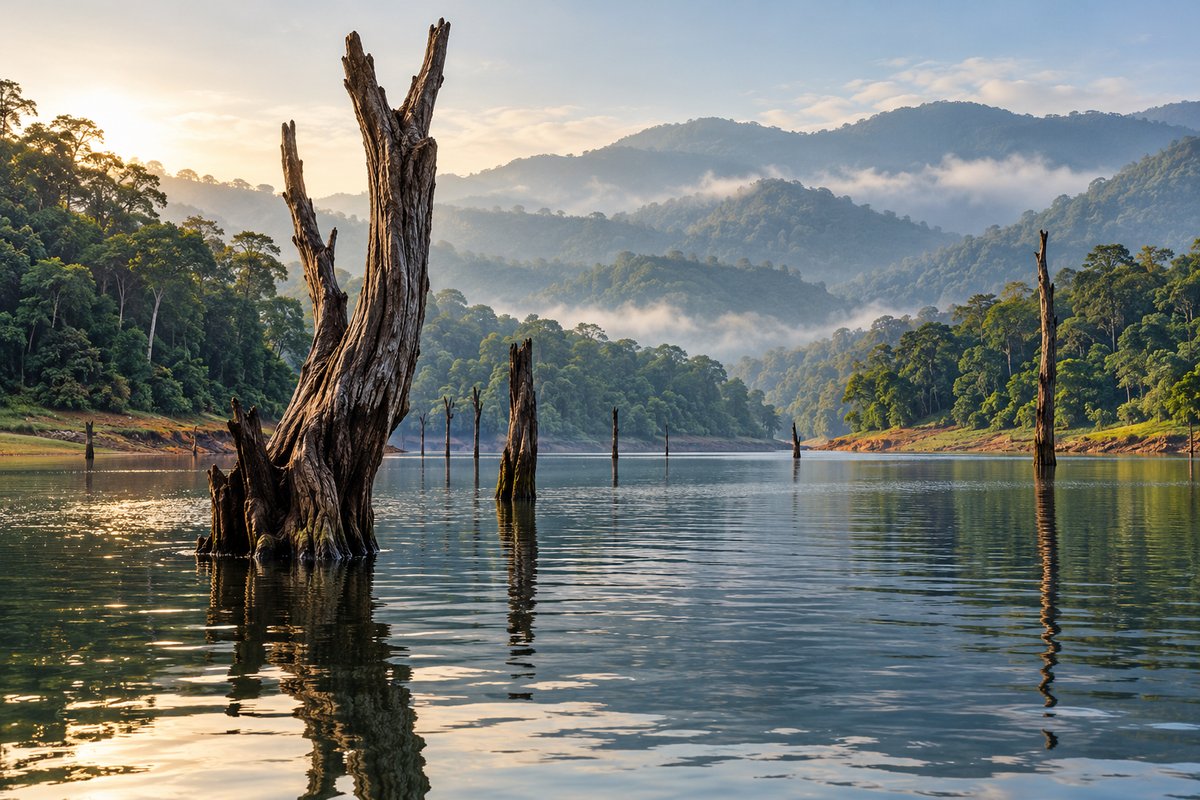
The bare tree trunks rising from Periyar Lake are among Thekkady’s most recognizable sights. Birds settle on them, boats pass between them, and visitors photograph their reflections against the forest.
But those trees raise an interesting question: why are they standing in water?
The answer begins with a nineteenth-century engineering project. The lake visitors see today formed after the construction of Mullaperiyar Dam in 1895. What looks like a natural opening in the forest is a reservoir created by holding back river water. Its story connects two very different landscapes: Kerala’s forested highlands and the drier agricultural regions across the Western Ghats in Tamil Nadu.
The Lake Was Built for Somewhere Else
Thekkady’s lake was not created for boating, wildlife watching or tourism. Its original purpose was to supply water beyond the mountains. The Periyar flows westwards through Kerala. The dam project aimed to divert part of its water eastwards towards the drier regions of what is now Tamil Nadu. Water stored in the reservoir could be carried through a tunnel across the Western Ghats to support irrigation.
This is the detail that makes the lake’s history particularly interesting. A project designed to serve farmland on one side of the mountains transformed a forest valley on the other. When you look across the water at Thekkady, you are seeing the local result of a much wider water-management scheme.
Why Send Water Across a Mountain Range?
Mountains influence where rain falls. Moist air rising over a mountain range cools, releasing rain. Areas beyond the mountains can receive less rainfall, a pattern known as the rain-shadow effect. The Mullaperiyar project sought to connect water available in the western highlands with areas that needed it farther east. The idea required more than a barrier across a river. The dam would store water, while the tunnel would provide a route through the mountains.
Kerala Tourism’s account of the Mullaperiyar Dam history describes construction beginning in 1887 and finishing in 1895, under the leadership of engineer John Pennycuick. Those dates place the lake in perspective. It is more than a century old, yet much younger than the hills and forests surrounding it.
How a River Valley Became a Lake
A dam holds back flowing water. As water accumulates upstream, it spreads into lower ground connected to the river. At Periyar, this changed the valley’s shape above the waterline. Ground that had supported vegetation became submerged, and hillsides became shores. Kerala Tourism records that the reservoir dramatically altered the valley’s landscape. The lake’s irregular outline becomes easier to understand once you know this. Its bends and narrow arms follow the terrain that existed before the water rose.
Imagine lowering the water in your mind. Some stretches would become valleys again. Higher ground would remain above them. The water has covered parts of the landscape, but its shape still reflects what lies underneath.
The Tree Trunks Are Clues to the Earlier Landscape
The trees projecting from the lake are remnants of vegetation submerged when the reservoir formed. Kerala Tourism describes these partially submerged trees as a distinctive feature of Thekkady. They help visitors understand something that a date on a signboard cannot fully explain: land occupied the space where the boat now travels. That does not mean every visible stump can be individually dated to the dam’s completion. It means the standing remnants offer a visible connection to the flooded landscape.
Look at their position during a visit. A trunk close to the shore and another farther out suggest how much of the earlier ground now lies beneath water. The view carries evidence of change in plain sight.
A New Shoreline Became Part of Wildlife Life
The reservoir introduced a large body of water into the forest landscape. Today, animals use its margins for drinking, while waterbirds find places to rest and feed. The old trunks have acquired a new role. Periyar Tiger Reserve identifies darters, egrets and kingfishers among the birds visitors may see resting on them. For a traveller, this creates an unusual scene: a remnant of the flooded forest supporting activity in the present.
However, the lake’s value to wildlife today should not be mistaken for proof that flooding caused no ecological loss. Creating a reservoir replaces land habitats with water and changes the conditions around its edges. Both parts belong to the story, the landscape that was submerged and the wildlife that now uses the lake.
The Shore You See Is Not a Permanent Line
A reservoir’s water level changes. Rainfall and water management affect how much land is covered, so its visible edges can look different between visits. At higher levels, water reaches farther up the slopes. At lower levels, more shoreline and longer sections of submerged trunks may become visible. This explains why photographs of the same lake can show different-looking banks. The hills remain, but the boundary between land and water moves.
When looking at the shore, notice the exposed ground between the water and established vegetation. It can help you recognise the lake as a changing reservoir rather than a fixed scenic feature.
Protection Followed, but Its Purpose Changed
The reservoir’s creation was followed by a series of changes in how the surrounding forest was managed. In 1899, the area became the Periyar Lake Reserve. According to Kerala Tourism, this early protection was intended to preserve royal hunting grounds against the expansion of tea plantations. Later designations reflected changing priorities. The Nellikkampatty Game Sanctuary followed in 1934, Periyar Wildlife Sanctuary in 1950, and inclusion in Project Tiger in 1978.
These milestones reveal that the present reserve did not emerge in a single step. Water engineering, hunting interests, forest protection and wildlife conservation belong to different chapters. The lake is part of that history, but the dam alone did not create the reserve’s biodiversity. The surrounding forests and their protection remain essential.
What to Notice on Your Next Visit
Knowing the lake’s origin gives you more to observe, even if large animals remain out of sight. Follow a narrow inlet and consider how water entered an earlier valley. Watch a bird using a dead trunk as a perch. Notice where exposed ground meets the forest. You can also ask your guide about the current shoreline and the history of the area you are passing. For the practical arrangements, the Periyar Lake boating guide covers tickets, reporting procedures and travel considerations.
The historical perspective adds something different to the journey. A boat ride becomes an opportunity to read the landscape: where water replaced land, where old trees remain, and where forest life continues around a human-made lake.
A Landscape with More Than One Story
Periyar Lake holds several histories together. It is an irrigation reservoir, a transformed valley, a place used by wildlife and a familiar part of a traveller’s experience of Thekkady. Understanding those connections makes the view more meaningful. The bare trunks are no longer simply unusual scenery, and the water is no longer just the setting for a boat ride.
For travellers exploring this region, Springdale Heritage is a heritage resort near Thekkady, located in Vandiperiyar. Its rooms and cottages near Thekkady offer accommodation options for a stay while discovering the lake and its surrounding landscape.